


Winter Weather Updates for Decatur, AL
(Last Updated Monday, January 26, 2026, at 2:05 p.m.)
Weather Update: Thawing Underway, but Black Ice and Life-Threatening Cold Remain Concerns
Source: National Weather Service – Huntsville
The National Weather Service reports that while conditions are beginning to improve across north Alabama, dangerously cold temperatures and lingering impacts remain a concern through Tuesday morning. Black ice may persist tonight and into early Tuesday, even as daytime thawing continues.
What We’re Seeing in Decatur Today
- Noticeable thawing:
Sunshine and slightly warmer daytime temperatures have helped improve conditions on many primary roads across Decatur. - Lingering black ice risk:
Despite thawing, patchy black ice may still be present; use caution while traveling.
The National Weather Service notes a high probability of above-freezing temperatures by Tuesday afternoon, which should further improve road conditions.
Cold Weather Advisory Remains in Effect
- A Cold Weather Advisory remains in effect from midnight tonight through 10 a.m. Tuesday.
- Wind chills may fall into the single digits or below zero, creating life-threatening conditions during overnight and early morning hours.
- Residents should continue protecting the Four P’s: people, pets, plants, and pipes.
Road Crews and Emergency Response
The City of Decatur’s Street Department crews and ALDOT have been working around the clock to treat roads, bridges, and overpasses throughout this weather event. Their efforts have greatly improved conditions, but freezing temperatures mean drivers should remain cautious, especially overnight.
The City extends sincere thanks to street crews, first responders, and public safety personnel who continue working long hours in difficult conditions to keep the community safe.
City Operations Update
- The City of Decatur and ALL City Departments will reopen for normal operations on Tuesday, January 27, 2026.
- The Decatur Landfill will reopen at 6 a.m. Tuesday.
City Council Schedule Update
- The Decatur City Council Work Session originally scheduled for Monday has been rescheduled to Tuesday, January 27, 2026, at 5 p.m.
Warming Center Available
As dangerously cold temperatures persist overnight, the Hands Across Decatur Warming Center is open to individuals without adequate heat. Residents are encouraged to share this information with anyone who may need a warm, safe place during the coldest conditions.
Looking Ahead
While conditions improve on Tuesday, the National Weather Service warns that life-threatening cold will continue the next couple of nights, with another surge of hazardous cold possible later this week.
The City will continue to share updates as needed through our official communication channels.
We Are Better Together!
_________________________________________________________
(Last Updated Monday, January 26, 2026, at 7:30 a.m.)
Weather Update: Bitter Cold Continues; Black Ice Remains a Concern This Morning
Source: National Weather Service – Huntsville
The National Weather Service reports that the winter storm has ended, but dangerously cold temperatures and lingering impacts remain across north Alabama, including Decatur. Hazardous driving conditions due to black ice may persist today and tonight, before gradually improving by Tuesday .
What to Expect Today
- Bitter cold:
Temperatures remain below freezing, with highs only reaching the 20s and low 30s. - Dangerous wind chills:
Wind chills are expected to dip into the single digits or below zero, especially during the early morning hours. - Cold Weather Advisory:
A Cold Weather Advisory remains in effect through noon today, and again from midnight tonight through 10 a.m. Tuesday, with wind chills as low as -5 degrees possible.
Road Conditions in Decatur This Morning
- Patchy black ice remains a concern:
While many primary roads are passable, slick and icy spots are still possible, especially on bridges, overpasses, shaded areas, and less-traveled roads. - Slow improvement expected:
The National Weather Service notes minimal improvement on roadways today, even as some sunshine returns. - Use caution if you must travel:
Roads may look clear, but still be icy. Drivers are urged to slow down, allow extra stopping distance, and avoid unnecessary travel.
Street Crews and First Responders
The City of Decatur’s Street Department crews have been working through the night and early morning hours, monitoring conditions and treating roads, bridges, and overpasses as temperatures remain below freezing. ALDOT crews are also actively treating state routes and highways throughout the area.
The City extends its sincere thanks to street crews, first responders, and public safety personnel who continue working in difficult and dangerous conditions to keep the community as safe as possible.
Warming Center Open
As dangerously cold temperatures persist, the Hands Across Decatur Warming Center is open to individuals without adequate heat. Residents are encouraged to share this information with anyone who may need a warm, safe place during the coldest conditions.
Closures and Schedule Impacts (Previously Announced)
The following closures remain in effect today:
- Decatur City Hall and ALL City Departments: CLOSED Monday, January 26, 2026
- Decatur City Schools: CLOSED Monday, January 26, 2026
- Decatur Municipal Traffic Dockets:
- Dockets scheduled for 8:30 a.m. and 10:30 a.m. are canceled
- New court dates will be mailed once rescheduling is complete
- Questions may be directed to court@decatur-al.gov or 256-341-4676
- Decatur City Council:
- The Work Session originally scheduled for Monday has been tentatively rescheduled to Tuesday, January 27, at 5 p.m.
- Additional Department Closures:
- Decatur Landfill and Decatur Animal Services are closed to the public today
Safety Reminder: Protect the Four P’s
Residents are reminded to protect the Four P’s during this extended cold snap:
- People: Dress in layers, limit time outdoors, and check on neighbors.
- Pets: Bring pets indoors and provide warm shelter.
- Pipes: Wrap exposed pipes and allow faucets to drip slowly.
- Plants: Cover or bring in sensitive plants.
Looking Ahead
Temperatures are expected to remain below freezing through Tuesday afternoon, with another stretch of colder-than-normal weather possible later this week. The City will continue sharing updates as conditions change.
Residents are encouraged to limit travel when possible, stay weather-aware, and rely on official City of Decatur communication channels for the latest information.
We Are Better Together!
(Next Update will be Monday afternoon or as conditions warrant.)
____________________________________________________
(Last Updated: Sunday, January 25, 2026, at 2:45 p.m.)
Weather Update: Winter Storm Ending, but Dangerous Cold and Black Ice Remain a Concern
Source: National Weather Service – Huntsville
The National Weather Service reports that the active winter storm is coming to an end, but dangerous cold and lingering impacts will continue across north Alabama through Tuesday. While freezing rain and sleet are expected to taper off this afternoon, hazardous driving conditions due to black ice and prolonged cold remain the primary concern.
What’s Changing This Afternoon
- Wintry precipitation winding down:
Rain should end this afternoon, with a brief chance of flurries behind the cold front. - Freezing expected:
As temperatures fall, wet roadways will freeze, especially after sunset.
Primary Concern: Tonight Through Tuesday
- Black ice risk:
Hazardous driving conditions are expected this evening through Tuesday, even when roads appear dry. - Dangerously cold temperatures:
Wind chills are forecast to fall into the single digits or below zero overnight and persist through Tuesday morning. - Limited improvement:
Some sunshine is expected Monday and Tuesday, but minimal improvement is expected on roadways, particularly in shaded areas, on bridges, and on overpasses.
A Cold Weather Advisory is in effect from midnight tonight through noon Monday, and again midnight Monday night through 10 a.m. Tuesday, with wind chills as low as -5 degrees possible.
City Operations and Overnight Response
City officials continue to closely monitor conditions.
Public safety and street departments will be working through the night to monitor conditions and respond as needed.
- The Decatur Street Department will continue treating priority routes, bridges, overpasses, and known problem areas, with crews on call overnight as temperatures drop and refreezing occurs.
- Even with treatment efforts underway, residents should plan for slick spots and limit travel when possible.
Warming Center Available
As temperatures remain dangerously cold, the Hands Across Decatur Warming Center remains available for individuals who do not have adequate heat. Community members in need are encouraged to use this resource during the coldest nights.
Closures and Schedule Impacts
The following closures and cancellations are in effect:
-
- Decatur City Hall and ALL Departments will be CLOSED Monday, January 26, 2026.
- Decatur City Schools will be CLOSED Monday, January 26, 2026.
- Decatur Municipal Traffic Dockets scheduled for Monday at 8:30 a.m. and 10:30 a.m. are canceled.
- New dates will be mailed once the rescheduling is complete.
- Questions may be directed to court@decatur-al.gov or 256-341-4676.
- Decatur City Council: The Work Session scheduled for Monday, January 26, 2026, has been tentatively rescheduled to Tuesday, January 27, 2026, at 5 p.m.
- Additional Department Closures: Decatur Landfill and Decatur Animal Services will be CLOSED to the public on Monday, January 26, 2026.
Safety Reminders: The Four P’s
Residents are reminded to protect the Four P’s during this prolonged cold:
- People: Dress in layers, limit time outdoors, and check on neighbors.
- Pets: Bring pets indoors and ensure warm shelter.
- Pipes: Wrap exposed pipes and allow faucets to drip.
- Plants: Cover or bring in sensitive plants.
Travel Tips
- Avoid unnecessary travel, especially overnight and early mornings.
- Assume bridges, overpasses, and shaded roads are icy, even if main roads look clear.
- Slow down and leave extra space between vehicles.
TVA Update
During a Sunday afternoon meeting, TVA leaders stated that their systems are running at peak performance and don’t expect any issues during the upcoming event. Be aware that false messages are being sent via email and social media, telling residents to be on the lookout for rolling blackouts. Again, this is a false narrative meant to alarm people.
City officials will continue coordinating with weather and transportation partners and will share updates through official City of Decatur channels as conditions evolve.
We Are Better Together!
(Next Update will be on Monday, January 26, 2026, at 9:00 a.m. or as needed.)
_________________________________________________________
(Last Updated on Sunday, January 25, 2026, at 10:00 p.m.)
Weather Update: Ice Threat Continues Today; Hazardous Driving Likely Through Tuesday
Source: National Weather Service – Huntsville
The National Weather Service reports that a winter weather event remains ongoing across north Alabama, with dangerous cold and hazardous driving conditions expected to persist through Tuesday. While the most significant ice impacts continue to focus west of Decatur, black ice and refreezing remain a serious concern locally, especially after temperatures drop later today.
Current Alerts
- Ice Storm Warning remains in effect for Lauderdale, Colbert, and Franklin (AL) counties through 6 p.m. today.
- Winter Weather Advisory remains in effect for Morgan County and surrounding areas through 6 p.m. today.
- A Cold Weather Advisory is in effect from midnight tonight through noon Monday, with wind chills as low as -5 degrees possible.
What’s Happening Today
- Freezing rain and slick roads:
Hazardous driving conditions are expected this morning, particularly in northwest Alabama. In the Decatur area, roads may look wet but can still be icy, especially on bridges, overpasses, and shaded roadways. - Rain through early afternoon:
Rainfall may temporarily improve driving conditions before colder air arrives. - Cold front moves through this afternoon:
As a strong cold front passes later today, temperatures are expected to fall back below freezing, setting the stage for widespread refreezing.
Increasing Concern: Sunday Afternoon Through Tuesday
- Refreeze begins Sunday afternoon:
Temperatures are expected to drop below freezing on Sunday afternoon, leading to rapid refreezing of wet roadways. - Extended black ice risk:
The National Weather Service warns of hazardous driving conditions due to black ice from Sunday evening through Tuesday, with minimal improvement expected Monday, even with some sunshine. - Bitter cold:
Wind chills are forecast to remain in the single digits or below zero through Tuesday morning, increasing the risk of frostbite and prolonging icy conditions.
Closures and Schedule Impacts
The following closures and cancellations have been announced due to weather conditions:
- Decatur City Schools will be CLOSED Monday, January 26, 2026.
- All Decatur Parks and Recreation facilities are closed for the weekend.
- Decatur Municipal Traffic Dockets scheduled for Monday at 8:30 a.m. and 10:30 a.m. are canceled.
- New dates will be mailed once they are reset.
- Questions may be directed to court@decatur-al.gov or 256-341-4676.
Additional closures or schedule changes will be shared as conditions evolve.
Safety Reminders
- Avoid unnecessary travel, especially Sunday evening through Tuesday.
- Assume bridges, overpasses, and shaded roads are icy, even if main roads appear clear.
- Protect people, pets, plants, and pipes as dangerously cold temperatures persist.
- Check on neighbors, especially older adults or anyone without reliable heat.
Looking Ahead
The National Weather Service is also monitoring the potential for another round of hazardous cold late next week. Updates will continue as forecasts are refined.
City officials will remain in close coordination with weather and transportation partners and will continue sharing updates through official City of Decatur channels.
Keep scrolling down for additional information that could help you!
We Are Better Together!
(Next Update will be on Sunday, January 25, 2026, at 3:00 p.m.)
_____________________________________________
(Last Updated: January 24, 2026, at 3:00 p.m.)
Weather Update: Hazardous Driving Likely After Sunday Afternoon as Bitter Cold Moves In
Source: National Weather Service – Huntsville
The National Weather Service reports a multi-day winter weather event continuing across north Alabama and southern middle Tennessee this weekend. While some improvement is expected during the day on Sunday, concern is increasing for hazardous driving conditions after a strong cold front moves through Sunday afternoon, with impacts expected to last through Tuesday.
What to Expect
- Ice and rain through Sunday:
Freezing rain remains the primary concern, especially in northwest Alabama, where an Ice Storm Warning remains in effect. In the Decatur area, lighter ice amounts are expected, but even small amounts can cause slick roads and black ice. - Front arrives Sunday afternoon:
Temperatures are expected to drop back below freezing around 3 p.m. Sunday. As this occurs, rainwater and runoff will refreeze, leading to widespread hazardous driving conditions. - Extended travel concerns:
The National Weather Service warns that black ice and slick roads may persist Sunday evening through Tuesday, especially on bridges, overpasses, and untreated surfaces. - Dangerous cold follows:
Wind chills are expected to fall into the single digits or below zero late Sunday night through Tuesday morning. A Cold Weather Advisory is in effect, with wind chills as low as -5 degrees possible.
Rain and Flooding
Rainfall totals of 2 to 3 inches are forecast through Sunday, with localized higher amounts possible. A marginal risk for localized flooding exists, particularly in low-lying areas and locations with poor drainage.
Closures and Schedule Impacts
Due to current and anticipated conditions:
- All Decatur Parks and Recreation facilities are closed for the weekend
- The Decatur Landfill closed Saturday morning.
- DYS Impact Day at Upsurge has been impacted by the weather
- Decatur City Schools will be CLOSED on Monday, January 26, 2026.
- Decatur Municipal Traffic Dockets scheduled for Monday at 8:30 a.m. and 10:30 a.m. are canceled. New dates will be mailed when they are reset. Inquiries can be directed to court@decatur-al.gov or 256-341-4676.
Additional closures or schedule changes will be shared as conditions evolve.
Looking Ahead
While some sunshine may return Monday and Tuesday, the National Weather Service notes minimal improvement in road conditions, as temperatures are expected to remain below freezing until at least Tuesday afternoon. Another round of very cold temperatures is possible late next week.
City officials will continue monitoring conditions and coordinating with weather and transportation partners. Residents are encouraged to limit travel beginning Sunday afternoon, prepare for prolonged cold, and follow official City of Decatur communication channels for ongoing updates.
Scroll down for additional information, as this blog is updated regularly.
We Are Better Together!
(Next Update on January 25, 2026, at 10:00 a.m.)
____________________________________________________
(Last Updated: January 24, 2026, at 12:50 p.m.)
Weather Update: Road Conditions
We are continuing to experience some icy spots across Decatur. If you must travel, use extreme caution, especially on bridges, overpasses, and shaded areas. Allow extra time to reach your destination.
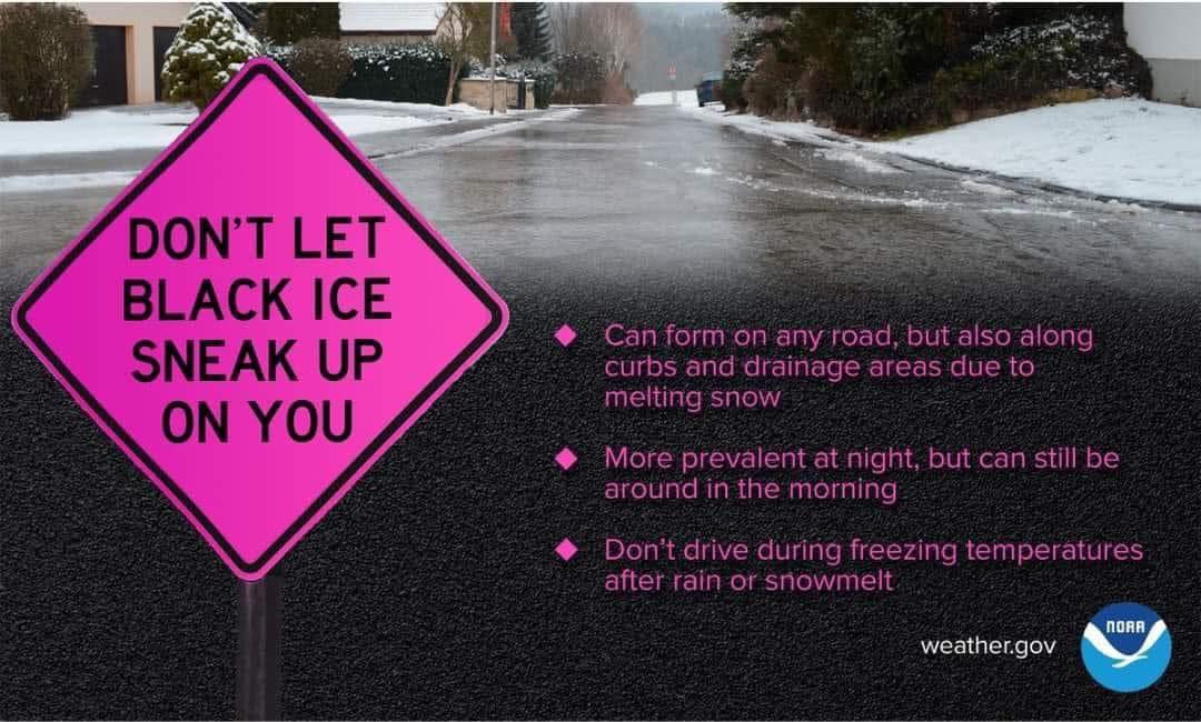
Black Ice Informational Graphic. Source: NWS
____________________________________________________
(Last Updated: January 24, 2026, at 10:50 a.m.)
Weather Update: Ice, Heavy Rain, and Bitter Cold Continue Through the Weekend
Source: National Weather Service – Huntsville
The National Weather Service reports a multi-day winter weather event continuing across north Alabama and southern middle Tennessee this weekend, followed by dangerously cold temperatures that could linger into the middle of next week.
Slick spots are being reported on roadways across the area Saturday morning due to freezing rain, and several wrecks have already occurred in the greater Decatur–Morgan County area. If you must travel, please use caution. As temperatures rise later today, ice on roadways is expected to melt.
Closures and Cancellations in the City of Decatur:
- Decatur Parks and Recreation Department has closed all facilities for the weekend.
- Decatur Landfill is closed on Saturday.
- DYS Impact Day at Upsurge has been canceled on Saturday.
Current Alerts
- Ice Storm Warning: Lauderdale, Colbert, and Franklin (AL) counties, in effect through 6 p.m. Sunday
- Winter Weather Advisory: Remaining counties in north Alabama and southern middle Tennessee, including the Decatur area, through Sunday night
The most significant ice impacts remain focused west and northwest of Decatur, while lighter but still impactful ice is possible locally.
What to Expect
- Ice:
- Northwest Alabama may see 0.25 to 0.5 inches of ice, with isolated totals up to 1 inch.
- In north-central Alabama, including Decatur, ice amounts are expected to be lighter, generally a glaze of up to 0.10 inch, with isolated higher amounts possible.
- Snow:
- Snowfall amounts are expected to remain below one inch across the entire area.
- Precipitation is expected to transition from snow or sleet to freezing rain and rain today.
- Rain and Flooding:
- 2 to 4 inches of rain is forecast from today through Sunday, with localized amounts up to 6 inches possible.
- The National Weather Service notes a marginal risk for localized flooding, especially in low-lying areas and locations with poor drainage.
Travel Impacts
The National Weather Service warns of widespread hazardous driving conditions, especially:
- This morning in parts of the region
- Again, Sunday evening through Tuesday, as wet roads refreeze and black ice develops
Even small amounts of ice can make bridges, overpasses, and untreated roads slick and dangerous.
Dangerous Cold Ahead
After precipitation ends, a life-threatening cold will settle into the area:
- Sunday night through Tuesday morning: Wind chills may fall into the single digits or below zero
- Temperatures: Much of north Alabama may remain below freezing through Tuesday, with some areas not warming above freezing until Wednesday
These conditions increase the risk of frostbite and could worsen travel and power-related impacts.
Looking Ahead
The National Weather Service also highlights a high risk of another surge of very cold temperatures late next week, with morning lows potentially dropping into the teens or lower across the Tennessee Valley.
City officials will continue monitoring conditions and sharing updates as forecasts evolve. Residents are encouraged to stay weather-aware, prepare for prolonged cold, and follow the City of Decatur’s official communication channels for the latest information.
We Are Better Together!
(Next Update on January 24, 2026, at 3:00 p.m.)
____________________________________________________
(Last Updated: January 23, 2026, at 3:15 p.m.)
Winter Weather Update: What Decatur Residents Need to Know
The City of Decatur is closely monitoring winter weather expected to impact the area this weekend and into early next week. While current forecasts favor Decatur with less ice than other parts of North Alabama, significant rain is expected. As temperatures drop rapidly Sunday evening, that rain could freeze, creating areas of black ice.
Street Department Readiness
The Decatur Street Department will have crews on call throughout the event to respond to any problem areas that develop.
According to City Engineer Carl Prewitt, roads will not be pre-treated ahead of the event. Because precipitation is expected to begin as rain, any pre-treatment would be washed away before freezing temperatures arrive.
If icy conditions occur, crews will prioritize the following locations:
Hospitals and Medical Routes
- Decatur Morgan Hospital
-
-
- 8th Street SE
- 6th Avenue SE to 14th Avenue SE
- 7th Street SE to Somerville Road SE
- Somerville Road SE to Medical Drive (top of hill)
-
- Decatur Morgan Hospital – Parkway Campus
-
- Betty Street SW
- 6th Avenue SW to Runnymeade Avenue SW
- Runnymeade Avenue SW to Carridale Street SW
- Service Road along the Beltline in front of the hospital
Overpasses and Elevated Areas
- 14th Street SW
- Gordon Drive SE
- Danville Road SW (hill near Solley House)
- Sand Hills
Additional overpasses as needed
These areas will be revisited as conditions change.
Public Safety Preparedness
Decatur Fire & Rescue and the Decatur Police Department are prepared to respond to emergencies throughout the weather event.
- Fire & Rescue is fully staffed and ready to respond. They will bring in additional firefighters if conditions escalate into an ice emergency.
- Decatur Police will monitor road conditions and close roadways that become unsafe for travel.
State-Maintained Roads
The Alabama Department of Transportation is responsible for:
- The Tennessee River bridges
- U.S. 31 South
- Highway 20
- The Beltline
- I-565 and I-65
ALDOT plans to treat the outside lanes of major roadways first if conditions warrant.
Ongoing Coordination
The City of Decatur remains in constant contact with the National Weather Service and Morgan County Emergency Management officials to monitor conditions and adjust response plans as needed.
Important Phone Numbers to Keep Handy
Emergencies — Call 911 for:
- Life-threatening emergencies
- Fires
- Medical emergencies
- Live power lines are down across roads or homes
Non-Emergency Assistance – Call 256-350-4613 for:
- Trees or lines blocking roadways
- Non-injury crashes
- Crimes not in progress
Power Outages (Call Your Utility Provider)
- Joe Wheeler EMC: 256-552-2300
- Decatur Utilities: 256-552-1400
- Hartselle Utilities: 256-773-2533
Road Conditions
- Website: www.algotraffic.com
- Mobile: ALGO Traffic App
We encourage residents to stay weather-aware, use caution if traveling, and check back here for updates as conditions evolve.
We Are Better Together!
(Next Update January 24, 2026, at 10:00 a.m.)
_________________________________________________________
(Last Updated: January 23, 2026, at 8:30 a.m.)
Weather Update: Ice, Heavy Rain, and Dangerous Cold Expected This Weekend
Source: National Weather Service – Huntsville
The National Weather Service continues to monitor a significant winter weather system expected to impact north Alabama and southern middle Tennessee late Friday night through Sunday night, followed by dangerously cold temperatures that could last into early next week.
Current Alerts
- Ice Storm Warning: Lauderdale, Colbert, and Franklin (AL) counties
- Winter Weather Advisory: Remaining counties in north Alabama and southern middle Tennessee
The greatest risk for significant ice accumulation remains focused in northwest Alabama, while areas farther east, including Decatur, are expected to see lower ice totals, though impacts are still possible.
What to Expect
- Ice:
-
-
- Northwest Alabama could see 0.25 to 1 inch of ice, with the highest totals west of Decatur.
- Elsewhere, including much of north-central Alabama, ice amounts are expected to be lighter, generally a glaze of up to 0.10 inch, but enough to create slick conditions.
-
- Snow:
-
-
- Snowfall amounts are expected to remain below 1 inch in most areas, with the highest totals near 1 inch confined to portions of northwest Alabama and southern middle Tennessee.
-
- Rain and Flooding:
-
- 2 to 4 inches of rainfall is forecast Saturday through Sunday, with localized higher totals possible.
- The National Weather Service has introduced a marginal risk for localized flooding, especially where drainage is poor or blocked by ice and debris.
Travel and Power Impacts
Even lighter ice accumulations can quickly lead to slick roads, black ice, and hazardous travel, particularly on bridges and overpasses. Heavier ice to the west could strain power lines, leading to outages. Residents are urged to limit travel during periods of freezing rain.
Dangerous Cold Follows the Storm
After the system moves through, a life-threatening cold is expected:
- Sunday night through Tuesday morning: Wind chills may drop into the single digits or below zero
- Temperatures: Much of the area may remain below freezing through Tuesday, with some locations not warming above freezing until Wednesday
These conditions increase the risk of frostbite and could worsen impacts if power outages occur.
Looking Ahead
The National Weather Service is also highlighting a high risk of much below-normal temperatures late next week, with morning lows potentially falling into the upper teens or lower across the Tennessee Valley.
City officials will continue to monitor conditions and share updates as forecasts evolve. Residents are encouraged to prepare now, stay weather-aware, and follow official City of Decatur communication channels for the latest information.
(Next Update: January 23, 2026, at 3:15 p.m.)
____________________________________________________
(Last Updated: Thursday, January 22, 2026, at 2:15 p.m.)
Weather Update: Ice Storm Warning Issued for Northwest Alabama
Source: National Weather Service – Huntsville
The National Weather Service has increased confidence that ice accumulation will be the primary hazard from a winter storm expected to impact the Tennessee Valley late Friday night through Sunday night. As a result, an Ice Storm Warning is now in effect for parts of northwest Alabama, while the rest of the region remains under a Winter Weather Advisory.
What’s Changed
Forecast trends continue to show warmer temperatures, leading to significantly lower snow totals but higher confidence in dangerous ice accumulation, particularly in Lauderdale, Colbert, and Franklin counties. The most impactful weather is still expected to begin later Friday night rather than earlier in the evening.
Current Alerts
- Ice Storm Warning: Lauderdale, Colbert, and Franklin (AL) counties
- Timing: Friday night through Sunday night
- Ice amounts: 0.25 to 1 inch or more, highest in far northwest Alabama
- Winter Weather Advisory: Remaining counties in north Alabama and southern middle Tennessee
What to Expect
- Ice: Heavy freezing rain in northwest Alabama may lead to downed trees, power outages, and impassable roads.
- Snow: Snowfall amounts are expected to remain below one inch across most of the area, with the highest totals near an inch in northwest Alabama and southern middle Tennessee.
- Rainfall: 2 to 4 inches is possible Saturday through Sunday, with higher totals that could cause ponding and localized flooding, especially where drains are blocked by ice or debris.
Travel and Infrastructure Impacts
Roads, bridges, and overpasses are expected to become slick and hazardous, particularly in areas under the Ice Storm Warning. Power infrastructure may be strained by the weight of ice on lines and trees. Residents should avoid unnecessary travel during the height of the storm.
Dangerous Cold to Follow
Behind the storm, life-threatening cold temperatures are expected:
- Sunday night through Tuesday morning: Wind chills may fall to 0 to 5 degrees, with some areas dipping below zero
- Temperatures: Many locations may stay below freezing until at least Tuesday afternoon, with higher elevations possibly not warming until Wednesday
These conditions increase the risk of frostbite and could worsen impacts if power outages occur
Looking Ahead
The National Weather Service continues to monitor the system and will provide additional updates. City officials are coordinating with emergency and utility partners and will share new information as it becomes available. Residents are encouraged to prepare now, stay informed, and take precautions to protect people, pets, and property.
(Next Update: January 23, 2026, at 10:15 a.m.)
_________________________________________________________
(Last Updated: Thursday, January 22, 2026, at 1:15 p.m.)
Hands Across Decatur Warming Center to Open Extended Hours
City officials continue to monitor conditions and coordinate with emergency and weather partners. Updates will be shared as forecasts are refined. Residents are encouraged to prepare now, protect people, pets, and property, and stay connected here with the latest information.
The Hands Across Decatur Warming Center will open Friday at 8:30 a.m. and remain open continuously through at least noon on Wednesday, weather permitting.
The warming center is open to anyone without adequate heat, whether unhoused or temporarily without safe warmth.
Location:
1027 5th Ave. SE
Decatur, AL
Volunteers Needed
Hands Across Decatur needs additional volunteers to operate safely during extended hours. Community support is essential. The center cannot remain open without it.
Friday
• 2–6 p.m.
• 2–6 a.m. (early Saturday)
Saturday
• 6–10 a.m.
• 2–6 p.m.
Sunday
• 6–10 a.m.
• 10 a.m.–2 p.m.
• 2–6 a.m. (Monday)
Monday
• 6–10 a.m.
• 10 a.m.–2 p.m.
• 10 p.m.–2 a.m.
• 2–6 a.m.
Tuesday
• 6–10 a.m.
• 10 a.m.–2 p.m.
• 10 p.m.–2 a.m.
• 2–6 a.m.
To volunteer, text 256-654-6371 with your name, your intention to volunteer, and your preferred shift.
Volunteer duties include helping enforce center rules and providing general support to guests.
Important Information for Guests
• No ID required
• Everyone must sign in
• Doors close at 8 p.m. each evening
• Individuals under the influence of drugs or alcohol will not be admitted
• All belongings, including coats, must be stored in lockers
Prohibited inside the center:
• Drugs
• Weapons
• Smoking
• Alcohol
Any aggressive behavior at any time will result in removal from the property. Authorities may be notified if necessary.
If you are cold and without safe heat, please come inside. Pride is not worth the risk.
How to Donate
PayPal: donate@handsacrossdecatur.org
Cash App: $haddecatur
We appreciate the community stepping up to help keep neighbors safe during this weather event.
Sue Terrell
Executive Director
Hands Across Decatur
We Are Better Together!
(Next Update: January 22, 2026, at 3:15 p.m.)
_________________________________________________________
(Last Updated: Wednesday, January 21, 2026, at 03:15 p.m.)
Source: National Weather Service – Huntsville
The National Weather Service continues to track a significant winter weather event expected to impact north Alabama and southern middle Tennessee from Friday evening through Sunday night. While forecast details are still evolving, confidence is increasing that freezing rain and ice accumulation, rather than heavy snow, will be the primary concern for much of the area.
Forecasters report a warmer trend, which is reducing expected snow totals but increasing confidence in impactful ice accumulation, particularly in northwest Alabama. There is also a growing signal that the most impactful winter weather may start later than initially expected on Friday.
Current Forecast Highlights
A Winter Storm Watch remains in effect from 6 p.m. Friday through 6 p.m. Sunday for the entire region.
- Snow and sleet: Generally 1 to 2 inches, mainly north of the Tennessee River
- Freezing rain: More than one-quarter inch of ice possible across much of the area
- Ice risk: Medium chances (40–70 percent) of exceeding 0.25 inches of ice, with the highest risk in northwest Alabama
Even light ice can create hazardous travel conditions, especially on bridges, overpasses, and untreated roads. Heavier ice could lead to downed trees and power outages.
Travel and Safety Concerns
The National Weather Service emphasizes that black ice will remain a concern, even during periods when precipitation tapers off, as lingering moisture will freeze in very cold temperatures. Residents should plan for dangerous driving conditions and avoid unnecessary travel during the storm’s peak.
Dangerous Cold to Follow
Behind the storm, life-threatening cold is expected:
- Sunday night and Monday night: Wind chills may drop into the single digits or below zero
- Temperatures: Many areas are expected to stay below freezing until at least Tuesday, meaning ice and snow may not melt quickly
These conditions increase the risk for anyone without reliable heat and could worsen impacts if power outages occur.
Looking Ahead
The National Weather Service also flags a moderate to high risk of much below-normal temperatures late next week, with overnight lows potentially falling into the upper teens or lower across the Tennessee Valley.
City officials are monitoring conditions closely and coordinating with weather and emergency partners. Additional updates will be shared as forecasts are refined. Residents are encouraged to prepare now, check on neighbors, and stay informed through official city channels.
(Next Update: January 22, 2026, at 10:15 a.m.)
_________________________________________________________
(Last Updated: Wednesday, January 21, 2026, at 10:15 a.m.)
The City of Decatur is actively monitoring a potential winter weather system expected to impact north Alabama later this week. City departments are coordinating with Morgan County EMA and the National Weather Service to track conditions and prepare as needed.
“Our team is monitoring the forecast closely and staying in regular contact with weather and emergency partners,” explained Mayor Kent Lawrence. “While there is still uncertainty, we want residents to know we are preparing and will share clear updates as conditions develop.”
At this time, no changes to city operations or services have been made. Updates will be shared here on the City of Decatur website as forecasts become clearer.
Media and residents are encouraged to check the city’s ongoing weather updates for the latest information.
Sorry, the comment form is closed at this time.